Google Earth Pro v4.1.7087 WinAll Included Patch Release 6th August 2007
Google Earth Pro harnesses the full power of the tool. Offering an expanded feature set, enhanced printing, and the fastest data delivery speed, it is the ultimate research, presentation and collaboration tool for geo-specific information. Google Earth Pro is used by successful, forward-thinking professionals to deliver complex data sets simply and clearly.
With Google Earth Pro, it’s easy to research locations and present your discoveries. In just a few clicks, you can import site plans, property lists or client sites and share the view with your client or colleague. You can even export high-quality images to documents or the web.
Annotate and visualize
Represent your location-based data using 3D drawing tools, or transfer up to 2,500 locations by address or geospatial coordinates from a spreadsheet. The GIS Data Importing Module lets you incorporate GIS data in file formats such as .shp and .tab. Examples include parcel, demographic, and 3D building data.
Share and analyze
Share your Google Earth views and data representations with your clients as a KML, Google Earth‘s original file format. With your upgraded Pro subscription, you get additional measurement tools (square feet, mile, acreage, radius and so on), so simply select the points on the screen using your mouse and let Google Earth calculate the rest.
Create visually powerful presentations
Export high-resolution images up to 11″ x 17″ 4800 pixels and use them in documents, presentations, web or printed materials. You audience can come along for the ride as you create your own compressed movies of the zooms and virtual tours you take in Google Earth.
Useful for many industries
Whether you’re in commercial real estate, insurance or media, Google Earth Pro lets you represent geo-specific information to full dramatic effect.
So now you can not only see high-resolution satellite imagery, but also read detailed information from various sources. See this animation to learn how to use the layer. Overlays in this release of Featured Content for Google Earth include:
United Nations Environmental Program (UNEP) – includes successive time-stamped images illustrating 100 areas of extreme environmental degradation around the world.
Discovery Networks World Tour – enables you to take a virtual tour of major world landmarks, cities, and natural wonders through Google Earth.
Jane Goodall Institute – you can visit Flirt and the other Gombe preserve chimpanzees and follow their daily exploits with the Institute’s "geo-blog" in Google Earth.
National Geographic – this features articles, pictures, live webcams and more around the world from National Geographic.
Tracks 4 Africa - Community generated map data across part of Africa along with photographs and interesting snippets about various places.
Spotlight on Africa - Flags and snippets of information about the 53 sovereign nations of Africa
Rumsey Historical Maps - Historical maps around the world spanning from year 1680 to 1892, including a Map of Africa from 1787.
European Space Agency – More satellite imagery of beautiful places and phenomena around the world
The Geographic Web layer contains similar content contributed by various user communities around the world, such as Wikipedia and Panoramio.
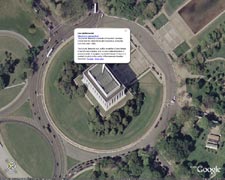
Here are some cool screenshots from the featured content layer:

Rumsey Historical Maps - World Globe 1790

UNEP - Mt. St. Helens

Discovery Networks - Taj Mahal

Goodall Institute - Gombe Chimpanzee
Though A Few Antivirus Like Norton Detects The Patch As Trojan,But There Isn't Any Virus In It, Its Just A Way To ---- The Google Earth. This Has Been Tested So Don't Complain About Trojans In It.
Download :
1st Copy
کد:
برای مشاهده محتوا ، لطفا وارد شوید یا ثبت نام کنید


.gif "N Aggressive (45)")
.gif "N Aggressive (33)")