این نرم افزار توسط شرکت Global Mapper طراحی شده است از ویژگیهای بارز این نرم افزار می توان به موارد زیر اشاره نمود: 1) به عنوان یک نرم افزاری برای نمایش انواع پایگاه داده های رستری و وکتوری در فرمتهای مختلف.
2) امکان دانلود داده ها از دستگاه GPS و در صورت استفاده از سیستم online نمایش موقعیت شخص حامل GPS بر روی نقشه ها.
3) این نرم افزار قادر به اتصال و دسترسی مستقیم به منابع رایگان داده های ماهواره ای از جمله داده ای ماهواره لندست و داده های توپوگرافی SRTM می باشد که علاوه بر دانلود نمودن آنها از سایتهای مربوطه امکان ویرایش و ذخیره سازی داده ها در فرمتهای مختلف نرم افزاری را فراهم می آورد .
4) امکان تهیه داده های سه بعدی و نمایش انها در زوایای مختلف از کل مناطق جهان.

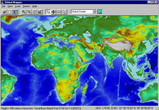
Global Mapper is more than just a viewer capable of displaying the most popular raster, elevation, and vector datasets. It converts, edits, prints, tracks GPS, and allows you to utilize GIS functionality on your datasets in one low cost and easy to use software package. Global Mapper also includes the ability to directly access the entire TerraServer database of USGS satellite imagery and topographic maps free of charge and to view elevation data in true 3D with any loaded raster imagery and vector data draped on top of it!
 [ برای مشاهده لینک ، با نام کاربری خود وارد شوید یا ثبت نام کنید ]
[ برای مشاهده لینک ، با نام کاربری خود وارد شوید یا ثبت نام کنید ]
Features:
[ برای مشاهده لینک ، با نام کاربری خود وارد شوید یا ثبت نام کنید ]
[ برای مشاهده لینک ، با نام کاربری خود وارد شوید یا ثبت نام کنید ]
[ برای مشاهده لینک ، با نام کاربری خود وارد شوید یا ثبت نام کنید ]
Features:
- Supports viewing of dozens of the most common data formats, including DLG-O, DRG, DOQ, DEM, DGN, DXF, SDTS DLG, SDTS DEM, ECW, MrSID, ESRI Shapefiles, E00, MapInfo MIF/MID, MapInfo TAB/MAP, GTOPO30, TerrainBase, SRTM, ETOPO2, ENVI DEM, JPG, PNG, BIL, BSQ, BIP, XYZ, Tiger/Line, Arc Vector Coverages, VPF (VMAP, DNC), S-57, ADRG, ASRP, CADRG, CIB, JPEG2000, GIF, NOS/GEO, Garmin PCX5, GPX (GPS eXchange Format), OziExplorer WPT/PLT, ASTER DEM (HDF and GeoTIFF formats), ASTER L1A/L1B imagery, Zmap Plus Grids, LIDAR LAS, Marplot MIE, DHM (Swiss DEM), MODIS imagery, etc.
- Provides direct access to the complete TerraServer satellite imagery and topographic map archive for the entire US for free within the application!
- Supports true 3D viewing of loaded elevation data including draping of any loaded imagery and vector data over the 3D surface.
- Crop, reproject, and merge any combination of raster data and elevation data, including DRGs. You can also crop data to an area feature.
- DIGITIZING SUPPORT! You can digitize new vector (area, line, and point) features by drawing them with the mouse. You can also edit existing vector features. Newly created and editing features can be saved to any of the supported export formats. In addition, shapes like rectangles, circles, ellipses, arcs, and concentric range rings. can be easily drawn as well.
- GPS SUPPORT! You can track a compatible GPS device connected to your computer's serial port or USB port in real-time over any loaded data. In addition, you can mark waypoints at the current GPS location and record a tracklog of where your GPS device has been while connected, all seamless with your loaded map data!
- EXPORT SUPPORT! You can export both vector, raster, and elevation data to a variety of formats (see below). You can merge any combination of data sets, regardless of source scale, type, and projection. You can also breakup your data into a regularly spaced grid on export if you'd like as well. Here is a partial list of supported export types.
- Vector Data (i.e. DLG's, Shapefiles, DXF, etc.)
- Garmin PCX5 TRK and WPT formats
- GPX (GPS eXchange Format)
- PLS CADD XYZ Grid file format
- SVG (Scalable Vector Graphic) format
- o Raster Data (i.e. DRG's, DOQ's, etc.)
- o Elevation Data (i.e. DEM's, etc.)
- BT (Binary Terrain) format
- DXF (3D-point, 3D-mesh, and 3D-face) formats
- Leveller Heightfield file format
- MapMaker Terrain file format
- PLS CADD XYZ Grid file format
- Surfer Grid (ASCII and binary) formats
- Terragen Terrain file format
- IMAGE RECTIFICATION! You can graphically rectify (georeference) any JPG, TIFF, or PNG image and save the results to a new fully georeferenced image. Vector data can also have a rectification process applied to it after loading to allow morphing vector data to fit other data sets.
- CONTOUR GENERATION! You can create contours for any combination of elevation data. You can also specify the contour interval to use. The generated contour data can then be exported to any of the supported vector export formats (see previous item for a list).
- Automatic triangulation and gridding of 3D point data sets, such as ASCII XYZ files. This allows you to convert a set of elevation samples into a fully gridded data set, which can then be used for contour generation, line of sight analysis, and view shed analysis, among other things. The data can also be exported to any of the supported elevation grid formats, such as USGS DEM.
- Advanced screen capture. You can capture the contents of the screen to a BMP, JPG, PNG, or (Geo)TIFF file of user-specified resolution.
- Batch conversion of almost any input data data files to any compatible export type.
- Auto-clip collar for DRG's. You can now have the collar of USGS DRG files automatically clipped off. This allows you to seamlessly view a collection of adjacent DRG files.
- Supports opening SDTS DLG, SDTS DEM, and most other file types directly from .tar.gz and .zip archives. This saves the major headache of decompressing each SDTS transfer into a separate directory.
- Comprehensive view shed analysis using loaded elevation grid data from a user-specified location, transmitter height, and radius.
- 3D Path Profiling and Line of Sight (LOS) capabilities, including receiver/transmitter heights, minimum clearance, and earth curvature options.
- Advanced measurement capabilities, including multi-segment path lengths and headings, enclosed area, and cut-and-fill volume calculations either along a path or within an enclosed area.
- Ability to link vector feature attributes to web sites or files.
- Support the latest DEM and SDTS DEM formats, including decimeter DEMs.
- Supports opening DLG-O and DEM files directly from gzipped archives. This means that you can save space and hassle by not having to decompress the data after you download it.
- Slide over text. When you move your cursor around the screen you'll get a description of the nearest feature automatically displayed in the status bar.
- Supports keyboard navigation. You can pan about with the arrow keys and zoom in/out with the page up/page down keys.
- Search and edit load vector data by name, attribute value, or description.
- And much more!
more info
@http://www.rockware.com/catalog/pages/globalmapper.html
کد:
برای مشاهده محتوا ، لطفا وارد شوید یا ثبت نام کنید
کد:
برای مشاهده محتوا ، لطفا وارد شوید یا ثبت نام کنید


 جواب بصورت نقل قول